
Projects
“Experience bicycle path” on the island of Bornholm, Denmark
Client
Year
January, 2014Project leader
Karla JankovičProject group
Project location
Assignment type
IDZ, IDP, PGD, PZI, 3D modeliranjeInvestment value
€6.500.000Partners
RESEA group: Lineal d.o.o., IRGO Consulting d. o. o., Gravitas d.o.o., Skanding d.o.o.External collaborators
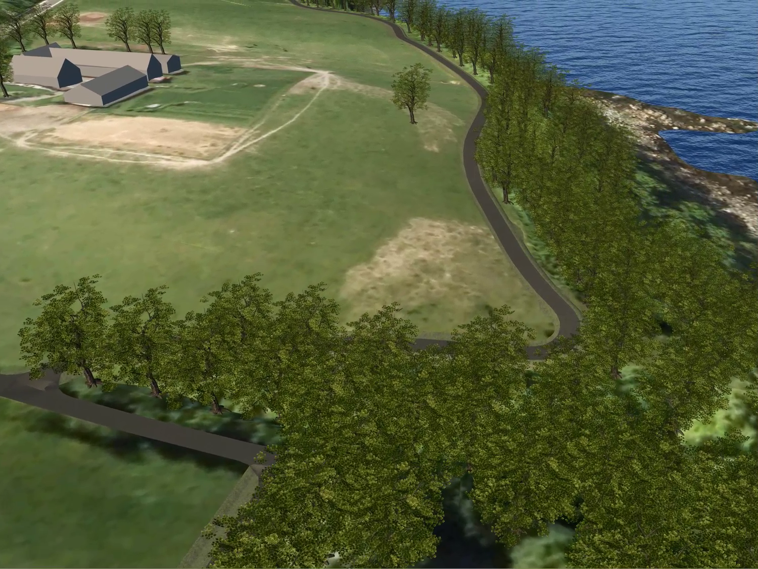
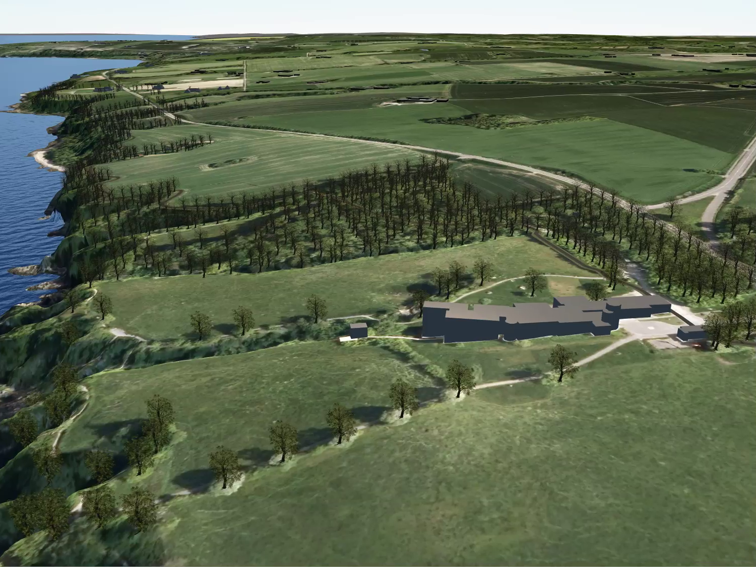
The design subject is the concept solution of the track of »Experience path« »Oplevelsessti«, in the north east side of Bornholm, Denmark. This part of the track is the realisation of the last section of bicycle paths around the coastal island lines of bicycle system tracks. The section of the path is situated between the Bornholm Agricultural museum (to be developed into museum of local culinary) in Gudhjem, and an Art museum on the other side of the track. The track connects to existing tracks on both sides of the sections.
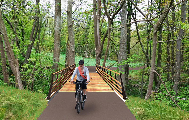
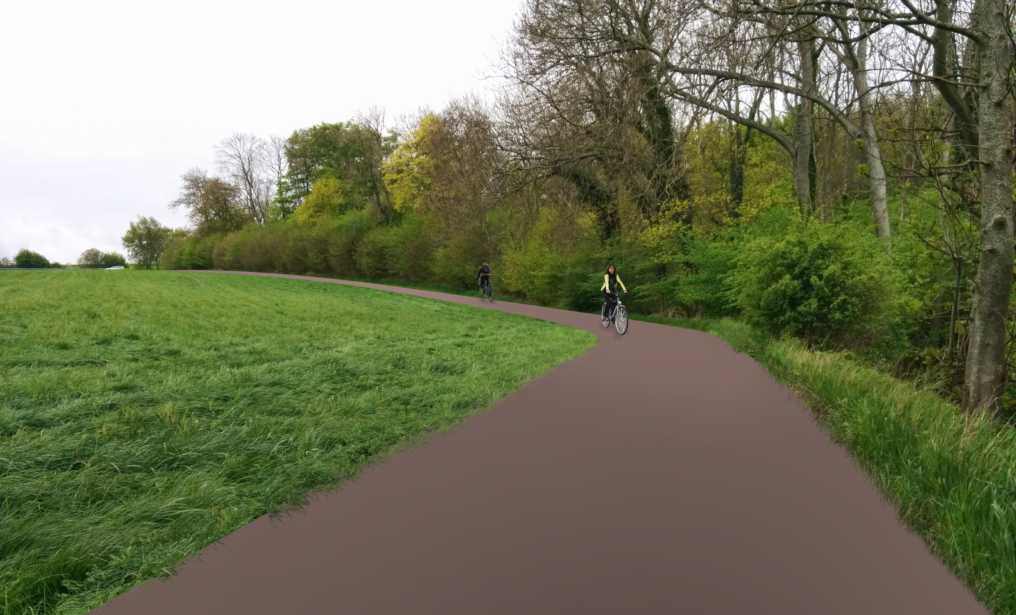
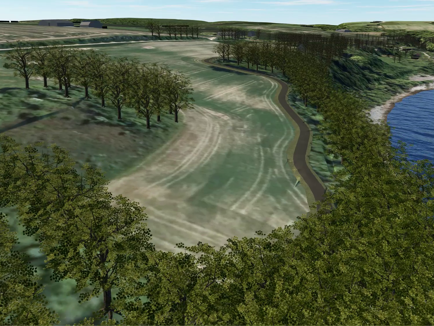
The track is defined as an »Experience path«, a bicycle track on three characteristic sections: The City, The Bay and The Coast. The experience path is placed in the landscape as a homogenous feature, following East and West directions in an alternating forested or open landscape. The track is conceptualised as a single two way track, with a characteristic width of 3 m (with possibilities of narrowing to 2 m at places of nature preservation and similar). The character of the surrounding landscape varies extensively. The character of the track itself is very diverse, with different kinds of surrounding landscapes, with diverse levelling in slopes in a dynamic relationship with the road on one side and with an existing footway on the next.
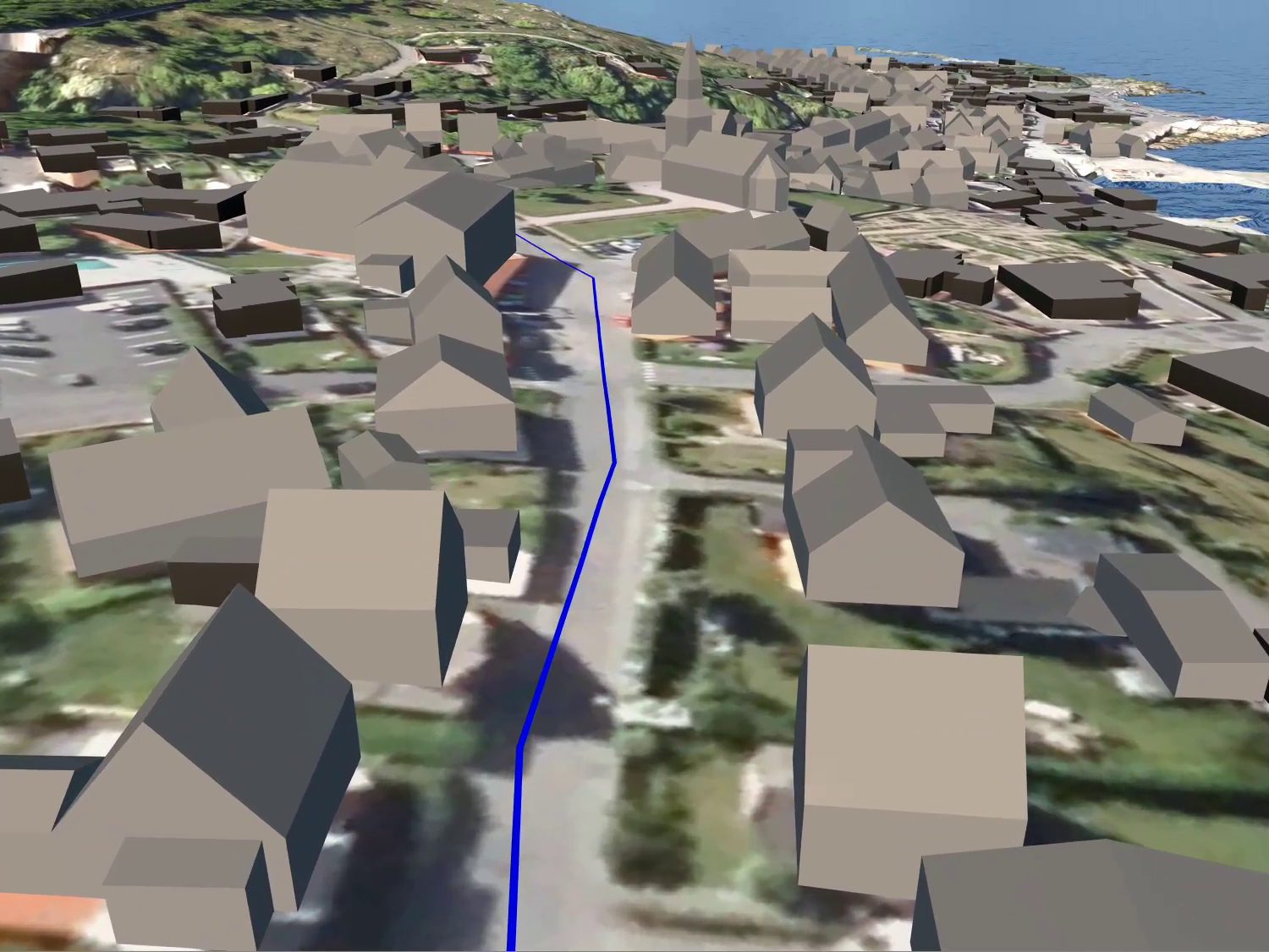
The City
The southernmost part of track is situated in the city of Gudhjem and uses its existing streets. New bicycle track will be labelled with a system of street signage. At the city borders, the track enters a forest and follows an existing forest track.
The Bay
The track follows an existing forest track towards the farming fields. In the deepest part of the bay, the track follows one of the two existing bridges. The track follows the road throughout the Bay area.
The Shore
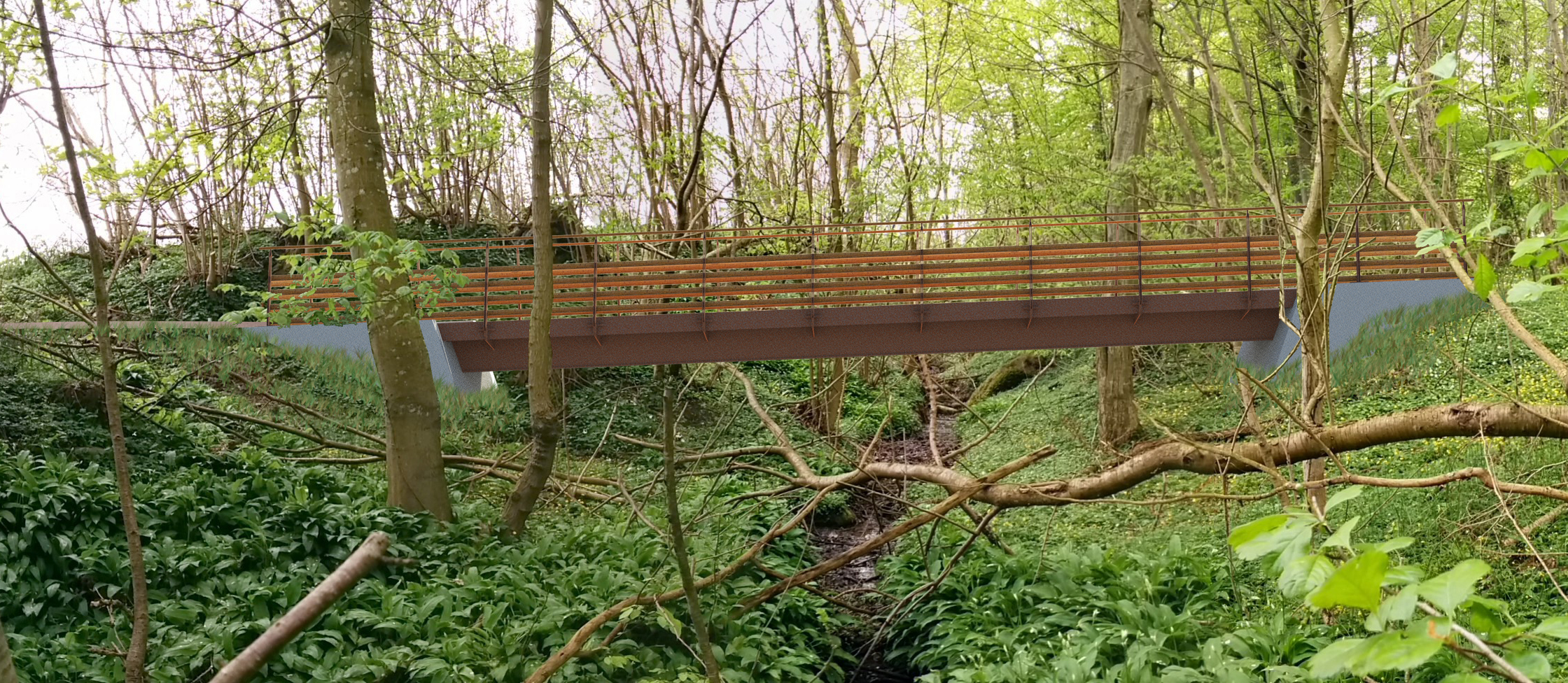
In the »Shore« part of the track, its diversity reaches the highest level. There are a number of existing nature protected areas. The track detaches from the existing road and meanders through the forest, and at its edges, offering views towards the sea. At a number of points, the track crosses (small) canyons and gorges, where there is a consideration of storm running water towards the sea. These crossings are planned as smaller bridgings.
